Okay, you gotta work with me here …
I did the math. When I cover less than about 7 trail miles (one way distance) on a given day, I’m actually going backwards – my projected date for finishing gets later, so it feels like I’m farther from my goal. I started today (February 28th) with a projected finish date of November 6th, hiked 13.2 out-and-back miles and found that, as a result, I’d finish the trail on November 7th.
And then I checked the map. As I hit the trail I headed northbound from Devils Fork Gap, but I was traveling south. Fortunately when I turned around and headed southbound I got back to where I started anyway.
You see? It’s Opposite Day. All day today Tennessee was east of North Carolina. Now that’s a pretty good trick, given the established fact that Tennessee is *west* of Missouri. Reliable reports from other parts of North Carolina confirm that the state does remain west of the Bermuda Triangle – hmmmmm – west of Tennessee too? Spooky! Glad I didn’t have to venture too deeply into Tennessee today – might never have come out.

Ahh, but seriously folks … logistics (lack of access points) dictated the short hike today. Still, what the hike lacked in length it made up for with some surprises. Not the least of these was a chance encounter with three dedicated maintainers from the Carolina Mountain Club. And one of them introduced himself as Lenny Bernstein, Appalachian Trail Conservancy board member – quite a trail celebrity (there are only 14 board members), quite an honor and a pleasure. He was out with Bob H. transferring responsibility for maintaining one section to him.

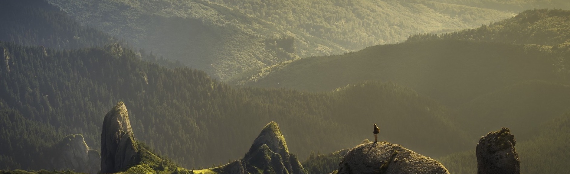
Where I met Lenny was near the summit of Lick Rock. (I didn’t see him lick any rocks, so I felt pretty confident that the name was ceremonial rather than some sort of requirement.) Nearby was another pleasant surprise – an excellent vista provided by a clearing that the USFS maintains for wildlife. You can see the cut in the mountain that construction of I-26 required, and beyond that is the summit of Bald Mountain, clearly visible on this bright almost summer-like day.

Finally, back down the slope a thousand feet or so, the trail passes a nice cascade, and despite it being Opposite Day none of the water seemed to be flowing uphill. But don’t worry, I can explain that based on the well-known alternative gravitational theory: “There is no gravity – the Earth just sucks”. This small part of the Earth definitely did not suck today … so according to the theory the water should be flowing up … except … it’s Opposite Day. (Are you dizzy yet?)
—————————————-
Here’s the track, showing the route of today’s hike as recorded on my GPS. Also, there’s a link to many more photos:
AT Day 53 – Lick Rock at EveryTrail
EveryTrail – Find the best Hiking in North Carolina
![]()